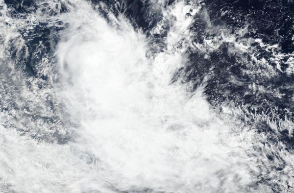
The latest tropical cyclone to develop in the Southern Indian Ocean is no threat to land areas. NASA-NOAA’s Suomi NPP satellite provided forecasters with a visible image of Tropical Storm Jeruto on April 15, 2020.
Visible imagery from NASA satellites help forecasters understand if a storm is organizing or weakening. The visible image created by the Visible Infrared Imaging Radiometer Suite (VIIRS) instrument aboard Suomi NPP showed Jeruto was being affected by wind shear after it developed. Vertical wind shear, that is, winds outside of a tropical cyclone at different heights in the atmosphere (the troposphere) push against a tropical cyclone and tear it apart.
The shape of a tropical cyclone provides forecasters with an idea of its organization and strength, and NASA-NOAA’s Suomi NPP satellite showed the storm appeared elongated, as outside winds were pushing clouds away from the center of circulation.
Read more at NASA/Goddard Space Flight Center
Image: NASA-NOAA's Suomi NPP satellite provided forecasters with a visible image of Tropical Storm Jeruto on April 15 shortly after it developed in the Southern Indian Ocean. (Credit: NASA Worldview, Earth Observing System Data and Information System (EOSDIS))