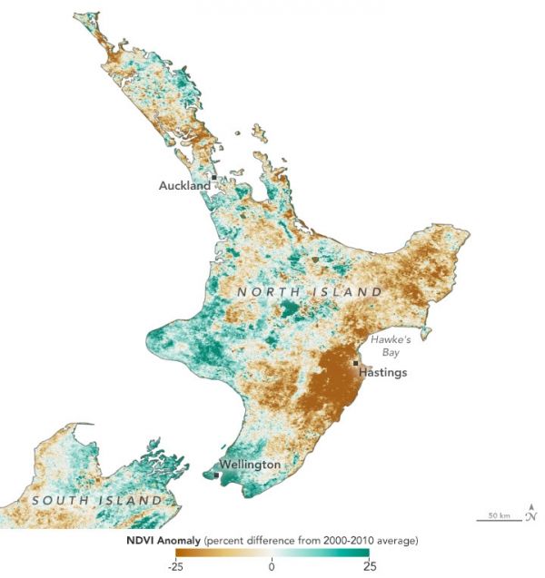
December through February—summer in the Southern Hemisphere—are typically the driest months in north and central New Zealand. The 2019-2020 summer season was especially dry, leaving the entirety of North Island in severe meteorological drought. March and April brought little relief, intensifying one of the most severe droughts on record for the region.
The drought’s impact on plants and trees is visible in these natural-color images, acquired with the Moderate Resolution Imaging Spectrometer (MODIS) on NASA’s Aqua satellite. The right image shows North Island’s Hawke’s Bay region on April 29, 2020; the left image shows the same region on May 2, 2019 (a more typical year). Much of the light green areas, which saw the most change, are pastoral and agricultural land; darker green areas are forested.
Continue reading at NASA Earth Observatory
Image via NASA Earth Observatory