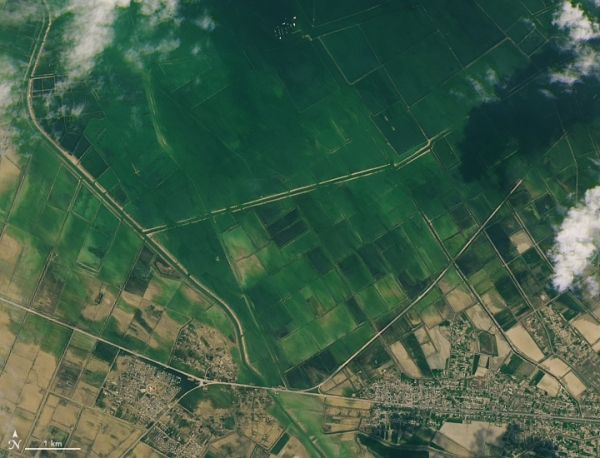
Flood waters continued to inundate villages and farmland one week after water breached the wall of a reservoir in Uzbekistan.
The western wall of a dam around the Sardoba Reservoir broke on May 1, 2020, following a week of heavy rain in the region. Images acquired on May 8, 2020, with the Operational Land Imager (OLI) on Landsat 8 show where that water ultimately collected in Uzbekistan and Kazakhstan. For comparison, the left image above shows the same area on April 22, before the dam failure.
Construction of the reservoir, located in Uzbekistan’s Sirdaryo region, was completed in 2017. It was designed to hold more than 920 million cubic meters of water for irrigation of the region’s agriculture.
Continue reading at NASA Earth Observatory
Image via NASA Earth Observatory


