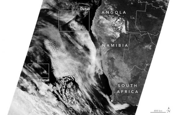
On the night of May 10, 2020, a layer of marine stratocumulus clouds hung low over the South Atlantic Ocean off the west coast of Africa, as is the case many nights. The cloud type commonly forms here because cool water at the ocean surface chills the air immediately above the water, causing water vapor to condense and form clouds. But the clouds that night, made visible in satellite images by reflected moonlight, displayed some particularly complex and beautiful wave patterns.
The phenomenon has similarities to waves moving through an ocean or lake. Waves form when water is disturbed—pushed upward by things like wind or a boat—and then pulled downward again by gravity. Waves also form in the atmosphere when air is disturbed—pushed up by things like mountains or islands, storms, or interacting air masses—and then gravity causes the air to fall again. Clouds can form at the crests of these waves, occasionally making the structures visible to human eyes. But given that the systems can span thousands of kilometers, they are perhaps best viewed from space.
Continue reading at NASA Earth Observatory
Image via NASA Earth Observatory


