As California and the American West head into fire season amid the coronavirus pandemic, scientists are harnessing artificial intelligence and new satellite data to help predict blazes across the region.
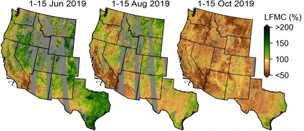
Anticipating where a fire is likely to ignite and how it might spread requires information about how much burnable plant material exists on the landscape and its dryness. Yet this information is surprisingly difficult to gather at the scale and speed necessary to aid wildfire management.
Now, a team of experts in hydrology, remote sensing and environmental engineering have developed a deep-learning model that maps fuel moisture levels in fine detail across 12 western states, from Colorado, Montana, Texas and Wyoming to the Pacific Coast.
Continue reading at Stanford University
Image via Stanford University