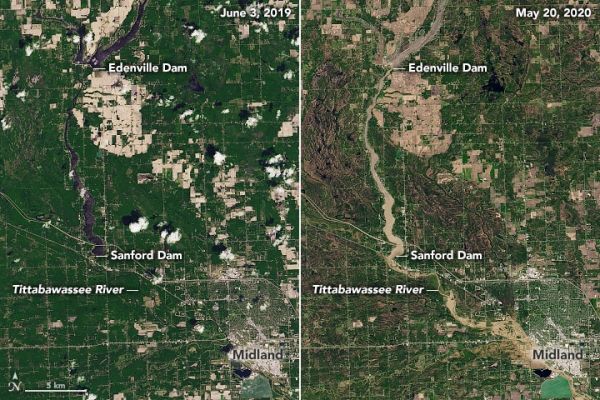
On May 17, 2020, heavy rain began pouring over the Tri-Cities region of central Michigan and, after two days, it provoked significant flooding in Midland County. The accumulating rainfall led to catastrophic dam failures that swelled rivers and streams and inundated several nearby communities. The governor ordered more than 10,000 residents of Edenville and Sanford to evacuate.
The natural-color images on this page show flooding across Midland County as observed by the Operational Land Imager (OLI) on Landsat 8. The pair above shows the Tittabawassee River on May 20, 2020 (right), compared to June 3, 2019 (left). The images below provide a wider view, including the location of the Edenville and Sanford dams.
Continue reading at NASA Earth Observatory
Image via NASA Earth Observatory