Along the Australian coast near Brisbane, the Moreton Bay area is known for its clear blue waters, vast sand banks, and diverse wildlife. But eight decades ago, it had a less placid existence as a major coastal defense port during World War II.
In the 1940s, Moreton Bay provided a direct Pacific passage for allies and enemies to approach Brisbane. The Queensland government thus strategically placed defense stations around Moreton Bay, and ships could not enter without undergoing an inspection by the Australian navy. Enemies and unidentified vessels were gunned or bombed.
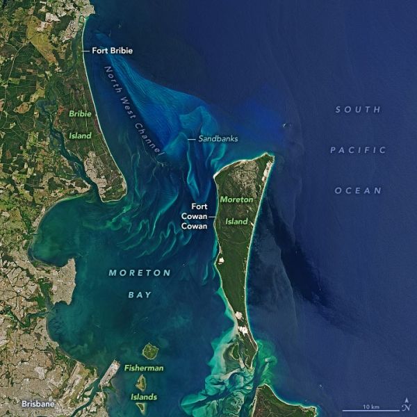
The natural-color image above shows the northern entry into Moreton Bay as observed on November 6, 2019, by the Operational Land Imager (OLI) on Landsat 8. The bay spans about 1,500 square kilometers (600 square miles). During WWII, the North West Channel served as a main shipping passageway and was guarded by Fort Bribie and Fort Cowan Cowan.
Continue reading at NASA Earth Observatory
Image via NASA Earth Observatory