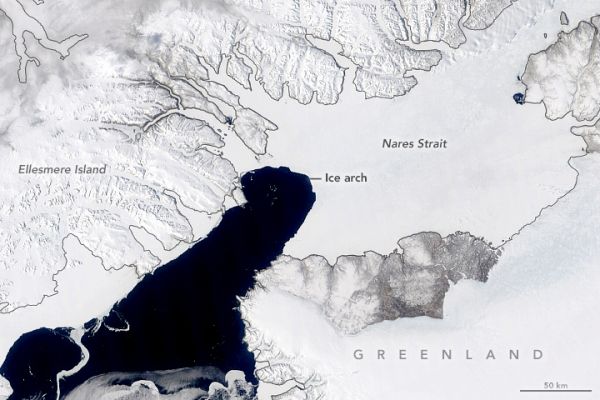
A structure in the Nares Strait known as an “ice arch” was still intact in late May 2020 when the Moderate Resolution Imaging Spectroradiometer (MODIS) on NASA’s Terra satellite acquired this natural-color image. But check it out while you still can. This natural gatekeeper—which prevents sea ice from exiting the Arctic Ocean and drifting southward into Baffin Bay—typically breaks up each year by June or July.
The Arctic Ocean is considered a semi-enclosed ocean, as it is surrounded almost entirely by land. The northern coastlines of these land masses—Eurasia, North America, Greenland—and some scattered islands keep most of the sea ice penned up, making it less mobile than sea ice that forms around Antarctica.
There are a few passageways, however, that allow ice to escape in spring and summer. The main passage is through the Fram Strait between northeast Greenland and Svalbard. Another is through the Nares Strait between northwest Greenland and Ellesmere Island. Nares Strait is relatively narrow, but a southward flowing current ensures plenty of Arctic sea ice is lost there each year.
Continue reading at NASA Earth Observatory
Image via NASA Earth Observatory


