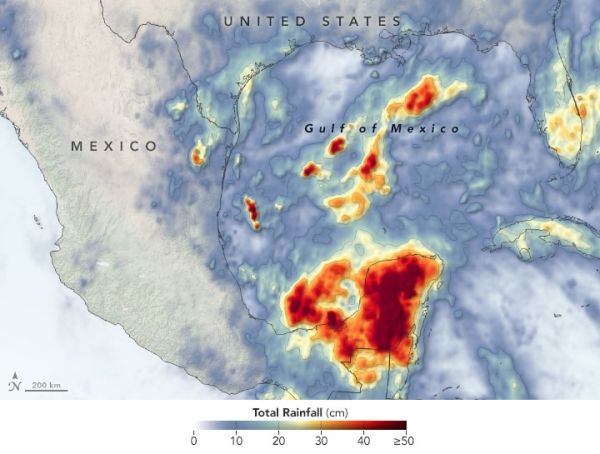
The 2020 Atlantic hurricane season is off to a busy start. By the first week of June, Tropical Storm Arthur had already brushed North Carolina, Tropical Storm Bertha had drenched South Carolina, and the third named storm of the year— Cristobal—was dropping torrential rain on the Yucatán Peninsula.
The storm first developed in the Pacific in late May as Tropical Storm Amanda, spinning off the southern end of a seasonal low-pressure pattern called the Central American Gyre. After making landfall in Guatemala and causing deadly floods in El Salvador, Amanda weakened and became less organized as it crossed Central America. It then reorganized and began to intensify as it reached the Atlantic Ocean and encountered the north end of the gyre. While lingering over the Yucatán Peninsula for several days, the storm dropped tremendous amounts of rain on parts of Mexico, Belize, and Guatemala.
The map above shows rainfall accumulation in Central America from May 27 to June 5, 2020. Rainfall totals were particularly intense in the Mexican states of Yucatán, Campeche, and Quintana Roo.
Continue reading at NASA Earth Observatory
Image via NASA Earth Observatory


