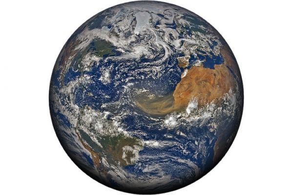
Every year, winds loft about 800 million metric tons of desert dust from North Africa—by far the planet’s largest source of airborne dust particles. The dust is often visible from space during the spring, summer, and early fall, when huge plumes of dry, dusty air from the Sahara Desert (the Saharan Air Layer) blow westward over the tropical Atlantic Ocean.
In June 2020, satellites captured these images of a Saharan Air Layer “outbreak” in progress. The top image, acquired June 18 with NASA’s Earth Polychromatic Imaging Camera (EPIC) on NOAA’s DSCOVR satellite, shows the scale of the plume in relation to continents bordering the Atlantic Ocean.
Continue reading at NASA Earth Observatory
Image via NASA Earth Observatory


