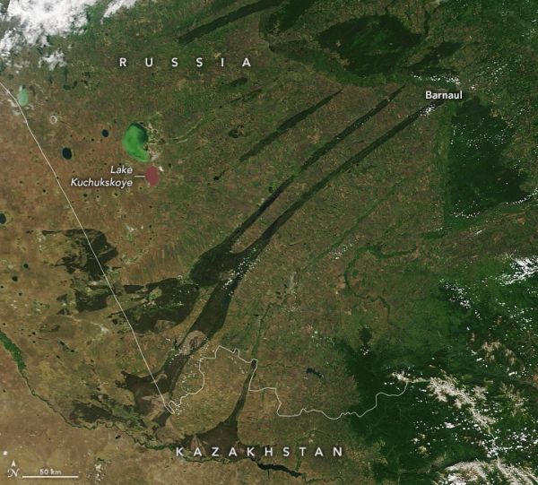
From above, the linear features in the Kulunda steppe of southwestern Russia looks as if a large claw has scraped the land surface. In reality, the features are a byproduct of tectonic forces that folded rock layers in ways that created shallow, boggy valleys that are now filled with pine forests and lakes.
The expansive grasslands surrounding the valleys has a long history of being one of Russia’s most important breadbaskets. Intensive production and overuse during the Soviet era led to significant erosion of the soil in many places, but farmers in the area still manage to grow a range of crops, including wheat, sunflowers, buckwheat, soybeans, flax, peas, and sugar beets.
The Moderate Resolution Imaging Spectroradiometer (MODIS) on NASA’s Terra and Aqua satellites acquired this pair of images on April 1 and June 11, 2020. The forested valleys appear dark green in comparison to the lighter green and brown farmland that surrounds them. The loss of snow and ice cover is the most obvious seasonal change in the image pair, but notice also how the color of Lake Kuchukskoye shifts from green to pink.
Continue reading at NASA Earth Observatory
Image via NASA Earth Observatory


