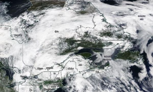
Visible imagery from NASA’s Terra satellite showed that Post-Tropical Cyclone Fay had moved into eastern Canada by July 11.
The Moderate Resolution Imaging Spectroradiometer or MODIS instrument that flies aboard NASA’s Terra satellite captured a visible image of Post-Tropical Storm Fay on July 11 at 1:30 p.m. EDT that showed the system had moved into eastern Canada.
At NASA’s Goddard Space Flight Center in Greenbelt, Md. visible imagery from NASA’s Terra satellite was used to create a time lapse of the movement of Tropical Storm Fay from July 9 to 11. The animation showed Fay had moved through upstate New York and into eastern Canada. The animation was created using NASA Worldview.
The National Hurricane Center noted that Fay’s remnants are still expected to be over Canada today, July 12. By 2 p.m. EDT (1800 UTC), the NHC expects the center of Fay to be near 52.5 degrees north latitude and 67.0 degrees west longitude, with maximum sustained winds near 20 knots (23 mph/37 kph) and diminishing. Fay’s remnants are expected to dissipate by 2 a.m. EDT (0600 UTC) on July 13.
Read more at NASA / Goddard Space Flight Center
Image: NASA’s Terra satellite provided a visible image to forecasters of the remnants of Tropical Storm Fay on July 11, 2020 as it was moving from New York State into eastern Canada. Credit: NASA’s Earth Observing System Data and Information System (EOSDIS) Worldview