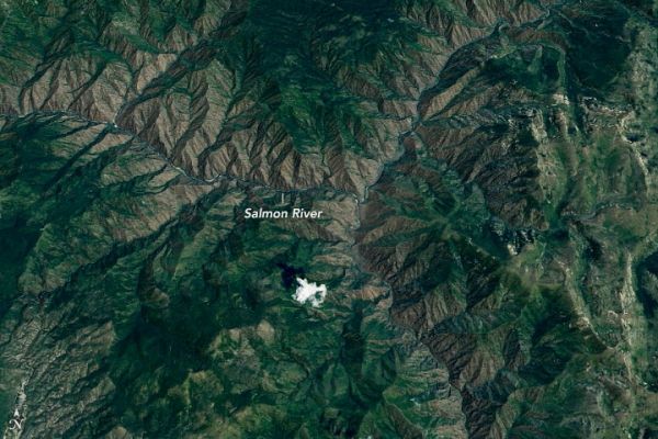
The Salmon River is among the longest free-flowing rivers in the United States. On its 425 mile (684-kilometer) course from the Sawtooth Mountains through central Idaho, not one functioning dam impedes its flow.
The river begins on the north slope of Norton Peak as a trickle, but soon swells into a roaring torrent as it absorbs runoff from multiple ranges. Over hundreds of millions of years, the river has carved some of the deepest gorges in the United States, some of which have more vertical relief than the Grand Canyon. The only deeper gorge in North America is nearby Hells Canyon.
On July 24, 2019, the Operational Land Imager (OLI) on Landsat 8 acquired this natural-color image of a rugged section of a canyon near the confluence of the South Fork and the Salmon River. Notice how it lacks the straight, sheer walls of the Grand Canyon. Instead, the water slowly carved a geologic wonderland of wooded granite ridges, eroded bluffs, and scattered stone towers and crags.
Continue reading at NASA Earth Observatory
Image via NASA Earth Observatory


