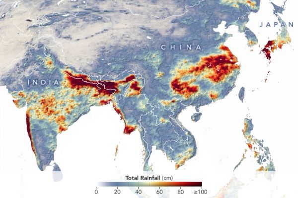
Rainfall that accompanies Asia’s summer monsoon plays an important role in the region’s economy by refilling aquifers, generating hydroelectric energy, and providing water for crops. In some years, however, the amount of rainfall breaks records in places. That has been the case in 2020. By mid-July, severe flooding affected millions of people across South and East Asia.
This map shows the rainfall accumulation across the region from June 1 (the start of the summer monsoon season) to July 20, 2020. The data are remotely-sensed estimates that come from the Integrated Multi-Satellite Retrievals for GPM (IMERG), a product of the Global Precipitation Measurement (GPM) mission. The darkest reds indicate places where GPM detected rainfall totals exceeding 100 centimeters (40 inches) during this period. Due to averaging of the satellite data, local rainfall amounts may be significantly higher when measured from the ground.
Continue reading at NASA Earth Observatory
Image via NASA Earth Observatory


