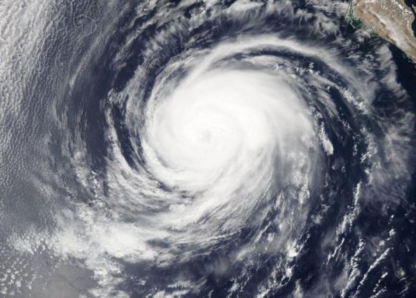
NASA’s Aqua satellite obtained visible imagery of Hurricane Elida in the Eastern Pacific as it continued to weaken. Imagery revealed that Elida’s eye had become covered as the storm embarks on a weakening trend over cooler waters.
The Moderate Resolution Imaging Spectroradiometer or MODIS instrument that flies aboard NASA’s Aqua satellite captured a visible image of Hurricane Elida on Aug. 11 at 4:30 p.m. EDT and the eye had become obscured by high clouds. The image also revealed that the storm looked more elongated, another sign a storm is weakening. Satellite imagery was created using NASA’s Worldview product at NASA’s Goddard Space Flight Center in Greenbelt, Md.
Elida has moved into cooler waters, causing the storm to weaken. The hurricane have moved over waters of 23 to 24 degrees Celsius (73.4 to 75.2 degrees Fahrenheit). A hurricane needs sea surface temperatures of at least 26.6 degrees Celsius (80 degrees Fahrenheit) to maintain intensity.
Read more at NASA/Goddard Space Flight Center
Image: NASA's Aqua satellite provided a visible image to forecasters of Hurricane Elida on Aug. 11 that showed the eye had become covered by high clouds and the storm appeared more elongated. (Credit: NASA Worldview, Earth Observing System Data and Information System (EOSDIS))