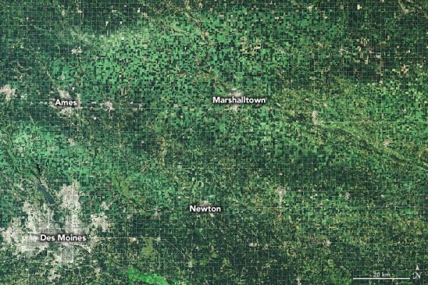
Despite facing a dry July, many farmers in Iowa were expecting a good harvest in the fall. Instead, many had their fields of corn and soybeans flattened by hurricane-force winds.
On August 10, 2020, an unusually strong and long-lasting line of thunderstorms—a derecho—battered vast swaths of Iowa and the U.S. Midwest. More than a week after the storm, tens of thousands of Iowans were still without electric power, and many farmers were mulling whether they could salvage crops and repair grain silos before the coming harvest.
The Operational Land Imager (OLI) on Landsat 8 captured an image of storm-damaged fields around Marshalltown, Iowa, on the day after the storm. For comparison, the second image shows the same area on July 10, 2020. Wind-damaged crops appear light green. Darker areas within the damage swath may be tree breaks or fields where crops took less damage.
Continue reading at NASA Earth Observatory
Image via NASA Earth Observatory


