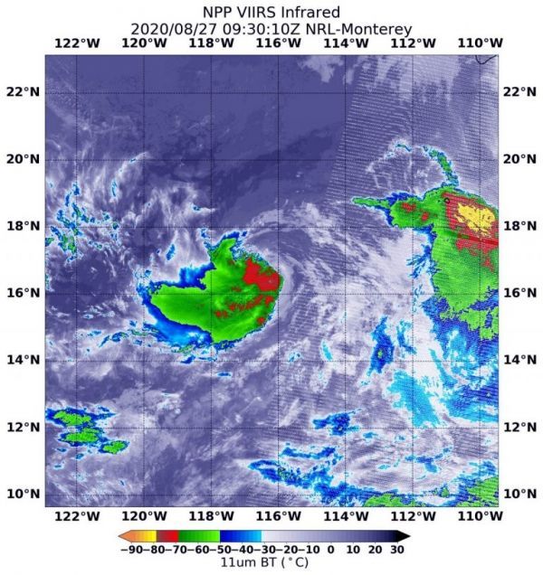
Tropical Depression 14E formed in the Eastern Pacific Ocean on Aug. 26 by 11 a.m. EDT (1500 UTC). By 5 p.m. EDT, it strengthened into a tropical storm and was re-named Iselle.
Tropical cyclones are made up of hundreds of thunderstorms, and infrared data can show where the strongest storms are located. That is because infrared data provides temperature information, and the strongest thunderstorms that reach highest into the atmosphere have the coldest cloud top temperatures. Strongest storms with cloud top temperatures as cold as minus 70 degrees Fahrenheit (minus 56.6. degrees Celsius) were west of the center and were dropping large amounts of rain.
Continue reading at NASA Goddard Space Flight Center
Image via NASA Goddard Space Flight Center


