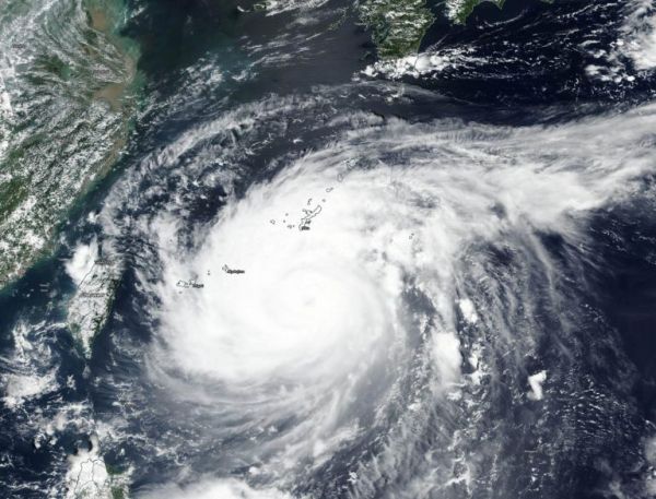
Typhoon Maysak continued to move through the Northwestern Pacific and was closing in on Japan’s Okinawa Island when NASA’s Terra satellite obtained a visible image of the storm. Maysak’s eye is not expected to go over the island, but pass just west of it.
The Moderate Resolution Imaging Spectroradiometer or MODIS instrument that flies aboard NASA’s Terra satellite captured a visible image of Typhoon Maysak. Imagery showed the eye of the storm appeared filled with high clouds, as powerful bands of thunderstorm circled it. Bands of thunderstorms from the south were spiraling into the low-level center.
On Aug. 31 at 5 a.m. EDT (0900 UTC), Typhoon Maysak was located about 144 nautical miles south of Kadena Air Base, Okinawa Island, Japan. It was moving to the north-northwest and had maximum sustained winds near 100 knots (115 mph/185 kph).
Maysak’s center is expected to pass just west of Okinawa within 24 hours. The storm is expected to make landfall in southern South Korea and will start to become extra-tropical.
Read more at NASA / Goddard Space Flight Center
Image: NASA’s Terra satellite provided a visible image to forecasters of Typhoon Maysak as it neared Okinawa Island, Japan on Aug. 31. Image Courtesy: NASA Worldview, Earth Observing System Data and Information System (EOSDIS).


