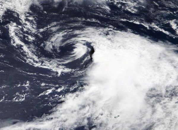
NASA’s Terra satellite provided a visible image that showed Tropical Storm Omar had weakened to a depression as it continued to be battered by strong upper level winds.
The Moderate Resolution Imaging Spectroradiometer or MODIS instrument that flies aboard NASA’s Terra satellite captured a visible image of Tropical Storm Omar on Sept. 2 at 1:30 p.m. EDT that showed outside winds pushing the bulk of clouds and storms east of the center. Using visible imagery, like this image from Terra, in addition to microwave and infrared satellite imagery, forecasters downgraded Omar from a tropical storm to a depression.
Satellite imagery was created using NASA’s Worldview product at NASA’s Goddard Space Flight Center in Greenbelt, Md.
Read more: NASA/Goddard Space Flight Center
NASA's Terra satellite provided a visible image to forecasters of Omar struggling against wind shear on Sept. 2 in the North Atlantic Ocean. Photo Credit: Image Courtesy: NASA Worldview, Earth Observing System Data and Information System (EOSDIS).


