After months of unusually heavy rain, thousands of people in Kenya’s Great Rift Valley have evacuated due to intense flooding. Rising waters have inundated homes, businesses, farms, and even entire islands. The torrential rains have also caused two important lakes to swell, creating several issues for local wildlife and businesses.
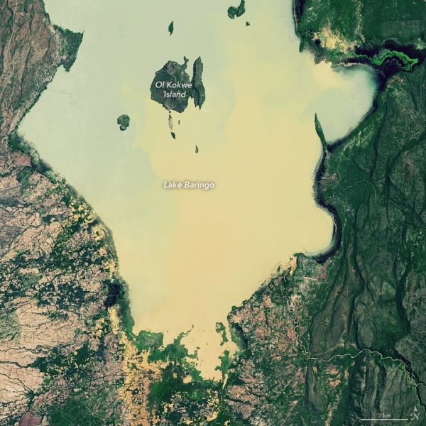
The natural-color images above show water levels on the south end of Lake Baringo on May 30, 2013 (left) and May 1, 2020 (right). The images below show flooding on the north end of Lake Bogoria, located less than 15 kilometers (10 miles) south of Lake Baringo. The images were acquired by the Operational Land Imager (OLI) on Landsat 8. Waters shaded brown and tan have heavy loads of suspended sediment.
The water levels of both lakes have been rising in recent years, but they have been particularly high in 2020. The senior warden for the Kenya Wildlife Service told Reuters that the area of Lake Baringo has expanded by 60 percent in the past seven years; it now covers 270 square kilometers (105 square miles). Lake Baringo has swollen by 25 percent, now covering 43 square kilometers (17 square miles).
Continue reading at NASA Earth Observatory
Image via NASA Earth Observatory