Rivers have long united people, so much so that a world without rivers would be unrecognizable. By providing fresh water, fertile land, and food—along with a convenient way to transport goods—rivers have long determined the locations of towns, cities, and ultimately entire civilizations.
Fertile river valleys were cradles to four of the earliest civilizations: the Tigris and Euphrates in Mesopotamia, the Nile in Egypt, the Indus in South Asia, and the Yangtze and Yellow in China, explained Brown University geographer Laurence Smith.
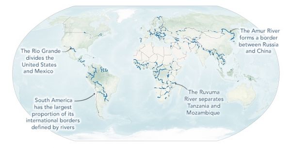
At the same time, rivers have long been used to divide lands. After visiting multiple rivers around the world, Smith became fascinated by the concept of the waterways as political borders. However, he also was surprised to find that little quantitative research on river borders is available—and even less that makes use of modern geospatial mapping techniques. With the help of Sarah Popelka, a student at UCLA, he set out to change that.
Continue reading at NASA Earth Observatory
Image via NASA Earth Observatory