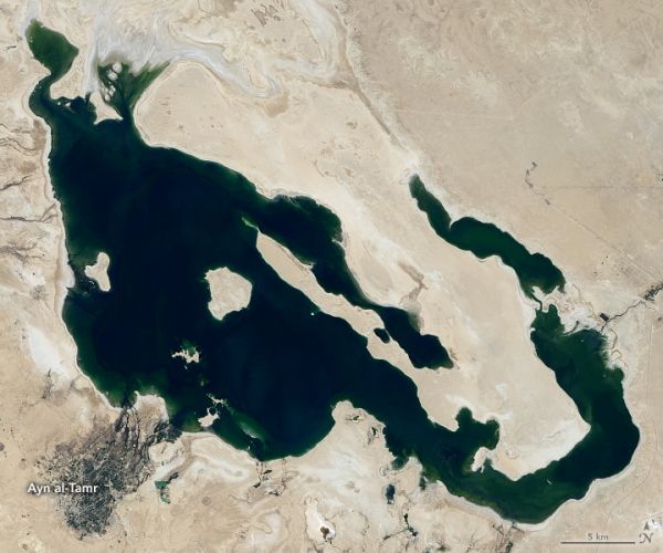
In the past three decades, several of Iraq’s largest lakes have experienced fluctuating water levels due to droughts, dam management, and conflict. Two lakes in particular—Milh and Habbaniyah—experienced substantial declines in water levels and lost much of their reputation as bustling resort areas.
Now satellite imagery shows the two lakes are refilling. The natural-color images above show Lake Milh on August 16, 2018 (left) compared to August 21, 2020 (right). The red color is most likely due to the presence of algae and bacteria with red pigments; a similar phenomenon occurs in a lake in nearby Iran. The images were captured by the Operational Land Imager (OLI) on Landsat 8. Older satellite imagery suggests that the lake has not appeared this full since 2009, although 2015 came close.
Lake Milh, also known as Lake Razzaza, was completed in the 1970s to receive excess water from Habbaniya Lake during flood season. Milh was one of Iraq’s largest lakes and a popular recreation spot in the 1980s. The islands within the lake served as important breeding areas for many birds, such as the flamingo.
Continue reading at NASA Earth Observatory
Image via NASA Earth Observatory


