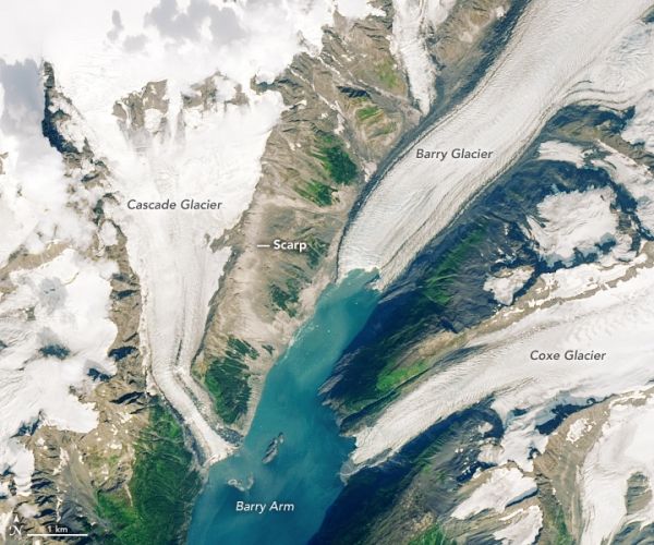
While kayaking in Barry Arm fjord in June 2019, Valisa Higman, an artist-in-residence at Alaska’s Chugach National Forest, noticed some odd fractures on a cliff overlooking the fjord. Curious if the slope might be in the process of collapsing, she emailed photos (see one of them below) to her brother, Bretwood Higman. “Hig” is a geologist with Ground Truth Alaska, and he has studied landslides and tsunami deposits for decades.
He was soon inspecting the area using Google Maps, zooming in to the maximum extent possible and searching for signs of slippage. He saw the cracks as well, but nothing about them struck him as strong evidence of a big landslide. “But it turns out I had made a geology 101 error,” he said. “I hadn’t zoomed out enough, and I missed the big picture.” Still, he kept Barry Arm on a list of possible landslides to investigate more someday.
A few months later, Chunli Dai offered that chance. The Ohio State researcher was working on a NASA-funded project to develop new ways to automatically detect landslides in the Arctic, and she was looking for test sites to check how well the tool was working. Her project makes use of a high-resolution dataset called ArcticDEM and machine learning to automatically search for and flag landslides.
Continue reading at NASA Earth Observatory
Image via NASA Earth Observatory