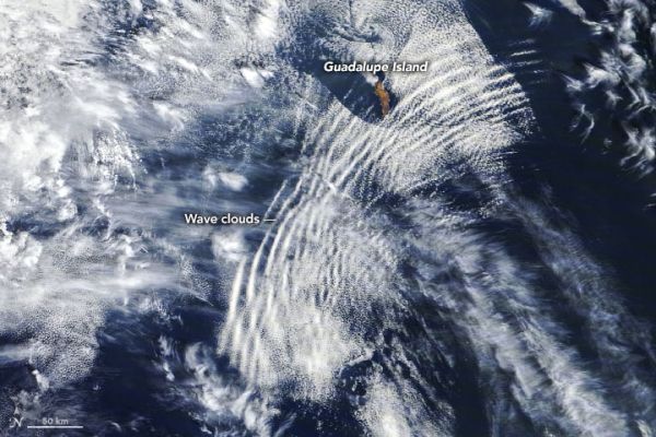
When the Moderate Resolution Imaging Spectroradiometer (MODIS) on NASA’s Terra satellite captured this natural-color image on October 4, 2020, a series of undulating cloud bands—an undular bore—rippled over the Pacific Ocean near Baja California.
Wave clouds (sometimes called undulatus or billow clouds) like these are the product of atmospheric gravity waves. They typically form when something forces a mass of air upward. The air cools as it rises and, if there is enough moisture in the air, the water condenses and forms clouds. After the air has passed over the obstacle, it typically sinks downward again. The air warms as it descends, preventing clouds from forming. But like ripples on a pond, the initial disturbance creates a propagating wave that continues to spread, causing air to rise and drop again and again until the wave dissipates. The end result is long lines of clouds that mark the crests of the waves, with cloud-free areas between them that correspond to the troughs of the waves.
Continue reading at NASA Earth Observatory
Image via NASA Earth Observatory


