When learning more about ancient rocks buried deep beneath the surface of the Earth, it may seem surprising to use futuristic technologies flown hundreds of feet in the air, but that has been central to the USGS Earth Mapping Resource Initiative. One year in, it’s time to take stock of what Earth MRI has achieved & where it’s going, using the results of a recent survey to lead the way.
In late 2019, residents near the confluence of the Ohio and Wabash Rivers might have noticed a small aircraft zig-zagging low in the sky over farms and country roads. This plane was in the process of scanning deep under the surface of the Earth to learn more about the region’s turbulent geologic past.
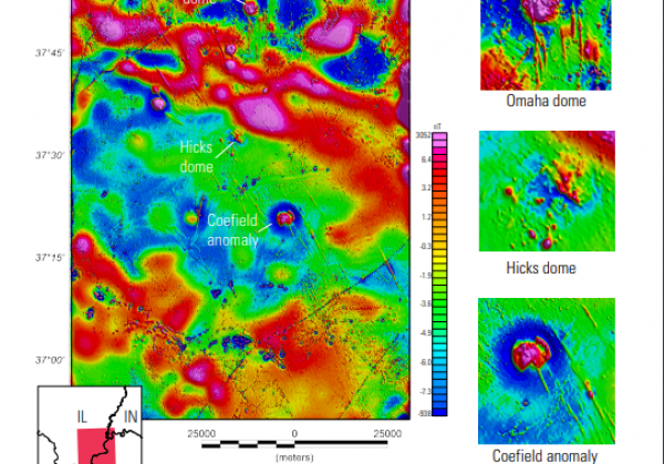
“When we think of southern Illinois and western Kentucky, we might envision rolling green hills, farm fields and the Ohio River. We don’t typically think of volcanic rocks that originated from magmas deep within the mantle and exploded their way through thousands of feet of older sedimentary rock. But that’s just what’s happened around 270 million years ago under what is now southern Illinois and western Kentucky,” said USGS scientist Anne McCafferty, who led the survey.
Continue reading at USGS.
Image via USGS.