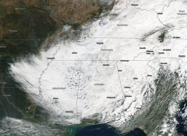
The Moderate Resolution Imaging Spectroradiometer or MODIS instrument that flies aboard NASA’s Terra satellite captured a visible image of Tropical Storm Delta on Oct. 11 at 1:30 p.m. EDT. The storm still appeared circular in imagery. At the time, it was centered over northern Alabama. At the time Terra passed overhead, Delta had weakened to a tropical depression with maximum sustained winds near 25 mph (35 kph).
Visible imagery from NASA’s Terra satellite captured from Oct. 9 to Oct. 12 were compiled into an animation. The animation showed the landfall and movement of Tropical Storm Delta. Delta dissipated over the southeastern U.S. and its remnants moved into the Atlantic states. The animation was created using NASA’s Worldview product at NASA’s Goddard Space Flight Center in Greenbelt, Md.
Continue reading at NASA Goddard Space Flight Center
Image via NASA Goddard Space Flight Center