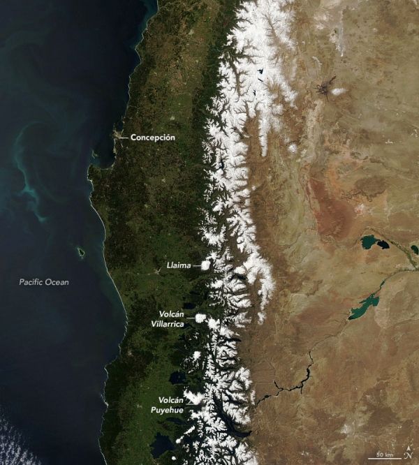
In September and October, springtime begins in South America as the traces of winter still linger in the mountains. In the Andes, the warmer temperatures mean the snow starts to thaw and melt, becoming a vital resource to local communities.
On October 11, 2020, the Moderate Resolution Imaging Spectroradiometer (MODIS) on NASA’s Terra satellite captured this natural-color image of the central Andes. The snow on the mountains appears smaller compared to mid-winter.
Spanning about 7,200 kilometers (4,500 miles), the Andes is the longest series of mountain ranges in the world. It runs through seven countries along the western coast of South America. This image shows about 700 kilometers (400 miles) of the range in Chile and Argentina.
Continue reading at NASA Earth Observatory
Image via NASA Earth Observatory