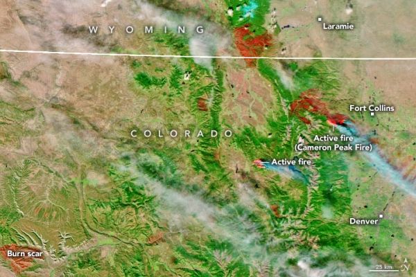
For much of the United States around and west of the Rocky Mountains, the summer and autumn of 2020 have been rough. Nearly 80 percent of the region is facing some level of drought, affecting 40 million people. Heat waves have intermittently baked various regions of the Southwest. And wildfires have raged, fueled by unusual lightning storms, parched vegetation, and other hints of a changing climate. The natural drama has been punctuated by the fact that Colorado and California have set records for the largest fires (by area) in each state’s history.
In northern Colorado, the Cameron Peak fire had consumed 206,000 acres (320 square miles) in the mountains west and northwest of Fort Collins and Estes Park by October 21, 2020. The fire ignited on August 13, and has burned through thick timber stands on rugged terrain in Arapaho and Roosevelt national forests. The natural-color and infrared images above were acquired on October 16, 2020 (the most recent clear view) by the Visible Infrared Imaging Radiometer Suite (VIIRS) on the Suomi NPP satellite.
Conditions significantly declined in mid-October when strong winds and persistently dry weather fanned the flames.
Continue reading at NASA Earth Observatory
Image via NASA Earth Observatory


