Researchers from the South Asia Institute and the Heidelberg Center for the Environment of Ruperto Carola investigated the causes of a glacial lake outburst with subsequent flooding in the Ladakh region of India. In order to frame the case study in a larger picture, the research team led by geographer Prof. Dr Marcus Nüsser used satellite images to create a comprehensive survey of glacial lakes for the entire Trans-Himalyan region of Ladakh. They were able to identify changes in the extent and number of glacial lakes over a 50-year period, including previously undocumented floods. This analysis allows them to better assess the future risk of such events, known as glacial lake outburst floods (GLOFs).
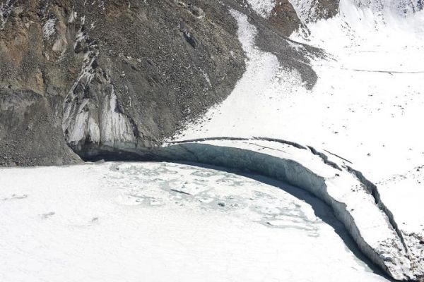
“In the wake of global glacier shrinkage caused by climate change, the danger from glacial lake outburst floods is seen as an increasingly pressing problem,” explains Prof. Nüsser of the South Asia Institute. An event like this unleashes huge amounts of water. Flash floods, for example, can wreak havoc on villages, agricultural areas, and infrastructure. To find out more about such events, the Heidelberg researchers studied a glacial lake outburst flood in Ladakh that destroyed houses, fields, and bridges in the village of Gya in August of 2014. Studies of the glacial lake, which is situated at 5,300 m above sea level, revealed a drastic short-tem lake level rise prior to the GLOF.
Read more at: University of Heidelburg
The ice-covered Gya glacier lake shortly after the GLOF event (Photo Credit: Marcus Nüsser)


