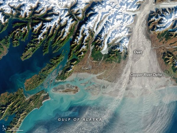
Dust storms are relatively common in places like the Sahara Desert. But they can happen at high latitudes, too, in places that are icy and dry. This image shows one of a handful of dust clouds that streamed over the Gulf of Alaska in autumn 2020.
The dust pictured here originated upstream in the Copper River Valley, where glaciers have crushed rocks into a very fine silt, or “glacial flour.” River water carries the silt south and deposits it along the delta and shore. Because the silt particles are so fine, they are easily lofted into the air by a stiff breeze.
Winds were especially strong on October 22, 2020, when the Operational Land Imager (OLI) on Landsat 8 acquired this natural-color image. A pressure gradient caused low-level air to accelerate out of the valley—a phenomenon known as a “gap wind”—and stir up a substantial amount of the silt.
Continue reading at NASA Earth Observatory
Image via NASA Earth Observatory


