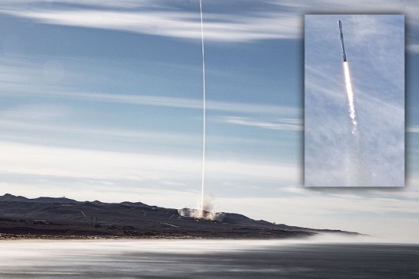
A joint U.S.-European satellite, built to monitor global sea levels, lifted off on a SpaceX Falcon 9 rocket from Vandenberg Air Force Base just after 9 a.m. Pacific Time on November 21, 2020. About the size of a small pickup truck, Sentinel-6 Michael Freilich will extend a nearly 30-year continuous dataset on sea surface height.
The satellite’s principal instrument is a radar altimeter, which monitors the height and shape of the ocean’s peaks and valleys—known to scientists as ocean surface topography. Radar altimeters continually send out pulses of radio waves (microwaves) that bounce off the surface of the ocean and reflect back toward the satellite. The instrument calculates the time it takes for the signal to return, while also tracking the precise location of the satellite in space. From this, scientists can derive the height of the sea surface directly underneath the satellite.
Sentinel-6 Michael Freilich will continue a sea level record that began in 1992 with the TOPEX/Poseidon satellite and continued with Jason-1 (2001), OSTM/Jason-2 (2008), and Jason-3 (2016). Together, these satellites have provided long-term, precise measurements of sea level height while tracking the rate at which our oceans are rising in response to global warming. Sentinel-6 Michael Freilich will eventually pass the baton to its twin, Sentinel-6B, scheduled for launch in 2025.
Continue reading at NASA Earth Observatory
Image via NASA Earth Observatory


