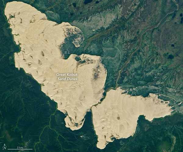
Within an expanse of boreal forest in northwestern Alaska, two treeless stretches of sand stand out—the Great Kobuk Sand Dunes. With crests that rise as high as 100 feet (30 meters) above the surrounding forests, the dunes look like they belong in the Saharan Desert more than in the Arctic.
The dunes owe their existence to glacial ice. During recent ice age cycles, massive sheets of ice bulldozed mountains and other rocky surfaces in the region, creating an abundance of sand, silt, and loess that collected along the banks of glacial streams. Over time, sediment-laden streams and dust-filled winds deposited much of that material in the ice-free Kobuk Valley, which is sheltered by the Baird Mountains to the north and the Waring Mountains to the south.
The Operational Land Imager (OLI) on Landsat 8 acquired this image of the Kobuk Valley and its dunes on August 16, 2020. While tundra grasses and forests have encroached upon and now cover about 90 percent of the sand that blankets Kobuk Valley, shifting winds still freely sculpt roughly 25 square miles (65 square kilometers) of active dunes fields. Ridge-like transverse dunes are common in the northern part of the Great Kobuk Dune Field, while crescent-shaped barchan and parabolic dunes appear in significant numbers in the southern part.
Continue reading at NASA Earth Observatory
Image via NASA Earth Observatory


