The new website, Drought.gov, features updated content and new interactive architecture designed to provide actionable, shareable information, and easy-to-understand graphics describing current drought conditions and forecasts by city, county, state, zip code, and at watershed to global scales.
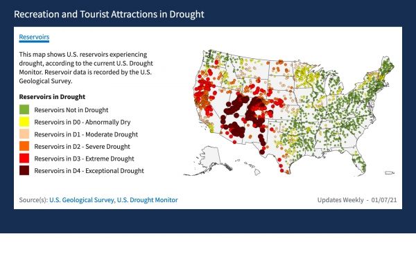
Drought.gov aggregates and presents drought impact data for economic sectors such as agriculture, energy, water utilities, tourism and recreation, bringing together interactive maps and data in one place, which you won’t find anywhere else.
“The new Drought.gov will help communities and economies across the United States understand and manage drought impacts,” said Veva Deheza, Executive Director of NIDIS. “Whether you’re looking for conditions in your neighborhood, or you’re an elected official responsible for water management decisions, Drought.gov is designed to be a one-stop shop for drought information, decision-support products, and educational resources.”
Continue reading at NOAA Research
Image via NOAA Research