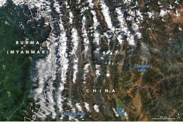
In the Chinese province of Yunnan, soaring mountain ridges flank a series of deep river gorges. The ridges rise well above 5000 meters (16,000 feet), while the lower parts of the gorges lie just a few hundred meters above sea level.
When the Moderate Resolution Imaging Spectroradiometer (MODIS) on NASA’s Terra satellite observed the region on January 6, 2021, one of the most striking features was an ephemeral one—long rows of parallel clouds that traced some of the ridges. The second image shows land elevation data for the region from the Shuttle Radar Topography Mission (SRTM). Slide between the two images to see how closely the clouds align with the ridges.
These orographic clouds form when the shape of the landscape (in this case, the ridges) forces moist air up to altitudes high enough and cold enough for the water vapor to condense.
Continue reading at NASA Earth Observatory
Image via NASA Earth Observatory


