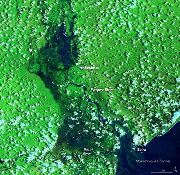
In late January 2021, Tropical Cyclone Eloise caused widespread damage and heavy flooding in central Mozambique. The storm displaced more than 16,000 people, damaged around 17,000 houses, and killed more than a dozen people across a few countries in southeast Africa.
These images show flooding on January 30, 2021, seven days after Eloise made landfall near the coastal city of Beira. The images from December 2019 are provided to compare the area under non-flooded conditions in the same season. The false-color images, acquired by the Operational Land Imager (OLI) on Landsat 8, use a combination of visible and infrared light (bands 7-5-3) to help differentiate flood water (dark blue), bare land (brown), and vegetation (bright green).
After crossing northern Madagascar and before making landfall on mainland Africa, Eloise slightly strengthened due to warm waters in the Mozambique Channel.
Continue reading at NASA Earth Observatory
Image via NASA Earth Observatory