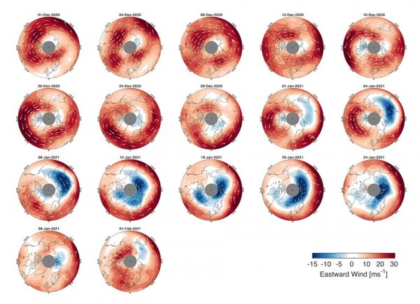
As this winter’s polar vortex currently sends extreme icy blasts of Arctic weather to some parts of the northern hemisphere such as the northeast of the US, scientists are using wind information from ESA’s Aeolus satellite to shed more light on this complex phenomenon.
The polar vortex is a huge mass of frigid air high above the North Pole in the polar stratosphere. It is surrounded by a strong jet of air swirling counter-clockwise along the vortex’s boundary. The vortex tends to be much stronger in the winter, keeping bitter cold air locked in around the Arctic.
However, sometimes the vortex can weaken, become distorted or even split into two and meander further south, affecting the weather and jetstream further down in the troposphere, potentially bringing unusually cold weather and snow to lower latitudes.
Continue reading at European Space Agency
Image via European Space Agency


