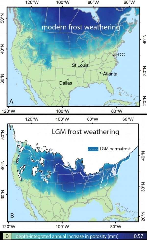
Cold temperatures, prevalent during glacial periods, had a significant impact on past and modern unglaciated landscapes across much of North America, according to a recent study by University of Arkansas geologist Jill A. Marshall.
Marshall, assistant professor of geosciences, is the first author of the study, published in the journal Geophysical Research Letters.
The findings help shape understanding of the earth’s “Critical Zone,” the relatively thin layer of the planet that extends from where vegetation meets the atmosphere to the lowermost extent of weathered bedrock. “Climate and ecosystems determine how quickly bedrock weathers, how soil is produced, how sediment moves on land and in rivers and other factors that shape the landscape,” the authors wrote.
In cold lands, such as Alaska today, frost can crack or weather rock that is at or near the surface of the earth – making it more porous and turning solid rock into sediment. By applying a frost-weathering model to North America paleoclimate simulations tracking temperatures during the Last Glacial Maximum approximately 21,000 years ago, Marshall and her team determined that a large swath of North America, from Oregon to Georgia and as far south as Texas and Arkansas, were likely affected by such periglacial processes.
Read more at University of Arkansas
Image: The extent of frost cracking in modern North America and during the last glacial maximum (Credit: Jill A. Marshall)


