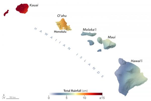
Torrential downpours and destructive flash floods swamped parts of Hawaii in March 2021. A strong low-pressure system fed by abundant moisture from the tropics fueled slow-moving storms that dropped inches of rain per hour in certain areas.
Hard hit areas included the northeastern side of Kauai, the windward slopes of the Ko‘olau Range on the island of O’ahu, the windward slopes of Haleakalā volcano on the island of Maui, and the southeast side of the Big Island of Hawai’i, according to National Weather Service meteorologists.
This map shows the rainfall accumulation across the region from March 5 to 12, 2021. The data are remotely-sensed estimates that come from the Integrated Multi-Satellite Retrievals for GPM (IMERG), a product of the Global Precipitation Measurement (GPM) mission.
Continue reading at NASA Earth Observatory
Image via NASA Earth Observatory


