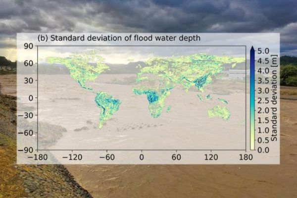
A research team from the Institute of Industrial Science, The University of Tokyo has conducted a detailed analysis of the uncertainties associated with flood risk modeling at the global scale. They found large uncertainties were mainly associated with runoff data. Flood magnitude is large in wet regions, but uncertainties in flood depth is larger in dry and mountainous regions affected by rare, extreme floods. The results of the study can be used to identify the key areas for improvement in hydrological modeling and improve future predictions of flood risk.
Assessment of the risk of rare and extreme floods is essential for disaster management and recovery planning at international, national, and regional levels. However, the accurate assessment of flood risk is limited by the number of observations possible, and relies on hydrological modeling which has limited performance. Theoretical flood hazard maps, which are relied on by governments, regional planners, insurance services, and other stakeholders, are an important part of understanding the potential extent of flood risk. However, they are subject to high levels of uncertainty, especially at the large scale.
"The main problem is that the creation of accurate flood hazard maps relies on excellent flood frequency analysis," explains study co-author Dr. Wenchao Ma, "and the main limitation of that is its reliance on assumptions about the underlying distribution of flood events, which is hugely variable among different regions of the world. There is no single solution that can be applied everywhere."
Read more at Institute of Industrial Science, the University of Tokyo
Image: Researchers from the Institute of Industrial Science, The University of Tokyo calculate sources of uncertainty in flood risks to improve global flood predictions (Credit: Institute of Industrial Science, the University of Tokyo)


