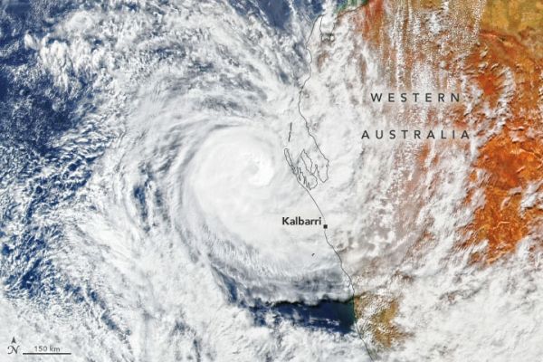
On April 11, 2021, a category three storm made a rare landfall in Western Australia, causing significant damage to coastal towns that are mostly ill-equipped for cyclones. Tropical Cyclone Seroja tore through 1,000 kilometers (600 miles) of land, knocking down trees and damaging buildings along its southward path. At least 15,000 homes lost power. Seroja has since weakened and moved offshore, but government agencies are now dealing with the damage.
The Visible Infrared Imaging Radiometer Suite (VIIRS) on the Suomi NPP satellite captured this image on April 11, hours before the storm made landfall.
Kalbarri, a resort town of around 1,500 people, received the brunt of the storm’s force. Seroja made landfall just south of Kalbarri on the evening of the 11th and damaged about 70 percent of the town’s structures, according to news reports. Wind gusts clocked in at 170 kilometers (100 miles) per hour—likely the strongest winds in the area in more than 50 years. Overnight, Kalbarri received around 167 millimeters (6.6 inches) of rain.
Continue reading at NASA Earth Observatory
Image via NASA Earth Observatory


