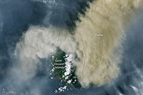
Eruptions at La Soufrière volcano have propelled ash and gas high into the air over the Caribbean islands of Saint Vincent and Barbados. The eruption—the volcano’s first explosive event since 1979—prompted thousands of people to evacuate.
The recent bout of explosive activity began on April 9, 2021. At about 10:30 a.m. local time that day, the Operational Land Imager (OLI) on Landsat 8 acquired this image of volcanic ash billowing from La Soufrière. The plume obscures the volcano below, a peak that stands 1178 meters (3,864 feet) above sea level on the northern side of Saint Vincent.
According to Jean-Paul Vernier, an atmospheric scientist with NASA’s Earth Applied Sciences Disasters Program, activity was apparent months before the explosive eruptions. It started with an effusive eruption in which magma that reached the surface slowly built up a lava dome. In April, the dome “finally turned out a massive explosion without many precursor signs,” Vernier said. Explosive eruptions result from the rapid expansion of pressurized gasses trapped in the rock or magma; the pressure violently breaks rocks apart and produces a plume of rock, ash, and gas.
Continue reading at NASA Earth Observatory
Image via NASA Earth Observatory


