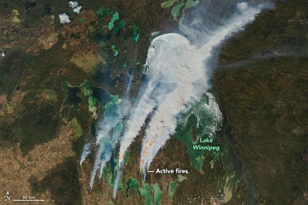
On May 7 and May 14, 2021, winter ice still covered most of Lake Winnipeg and the smaller lakes nearby, and walleye were starting to show up on fishing hooks. By May 19, most of the ice was gone, temperatures hovered between 30° and 33° Celsius (86° to 91° Fahrenheit), and the parched landscape was blanketed with smoke and fire. It seemed like Canada’s Manitoba Province had jumped right from winter to summer.
On May 18, 2021, the Moderate Resolution Imaging Spectroradiometer (MODIS) on NASA’s Aqua satellite acquired this natural-color image of smoke billowing from several intense wildfires west and southwest of Lake Winnipeg. Strong westerly winds drove the plumes across Hudson Bay and the Canadian interior as far as Quebec. Other fires (not shown) burned to the west in Saskatchewan and to the east in Ontario. Researchers examining NOAA GOES satellite images detected hints of pyrocumulus “fire cloud” formation south of Lake Winnipeg.
Continue reading at NASA Earth Observatory
Image via NASA Earth Observatory


