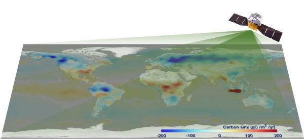
Using data on how carbon mixes with dry air collected from May 2017 to April 2018, researchers developed the first global carbon flux dataset and map. They published their results on July 22 in Advances in Atmospheric Sciences.
The map was developed by applying TanSat's satellite observations to models of how greenhouse gasses are exchanged among Earth's atmosphere, land, water and living organisms. During this process, more than a hundred of gigatons of carbon are exchanged, but the increase in carbon emissions has resulted in net carbon added to the atmosphere — now at about six gigatons a year — which is a serious issue that contributes to climate change, according to YANG Dongxu, first author and a researcher in CAS Institute of Atmospheric Physics (IAP).
"In this paper, we introduce the first implementation of TanSat carbon dioxide data on carbon flux estimations," YANG said. "We also demonstrate that China's first carbon-monitoring satellite can investigate the distribution of carbon flux across the globe."
Continue reading at Chinese Academy of Sciences
Image via Chinese Academy of Sciences


