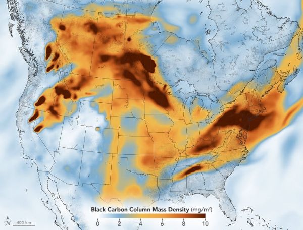
While plumes of wildfire smoke from western North America have passed over the northeastern U.S. and Canada multiple times each summer in recent years, they often go unnoticed. That is because smoke that spreads far from its source typically moves at a fairly high altitude—between 5 and 10 kilometers—as winds blow it eastward.
The situation has been quite different this week, as attention-grabbing smoke poured into the eastern U.S. on July 20-21, 2021. Data from NASA’s Micro-Pulse Lidar Network (MPLNET) and Aerosol Robotic Network (AERONET) indicated that a significant amount of smoke was hovering between the land surface and 2 kilometers (1 mile) altitude. Haze darkened skies and reddened sunsets, unleashed a rash of code red and orange air quality warnings, and even left the scent of smoke in the air in some areas.
Of the large cities in the northeast, Philadelphia and New York City had some of the haziest skies. The Visible Infrared Imaging Radiometer Suite (VIIRS) on NOAA-20 captured the natural-color image of smoke over the northeast shown above on July 20.
Continue reading at NASA Earth Observatory
Image via NASA Earth Observatory


