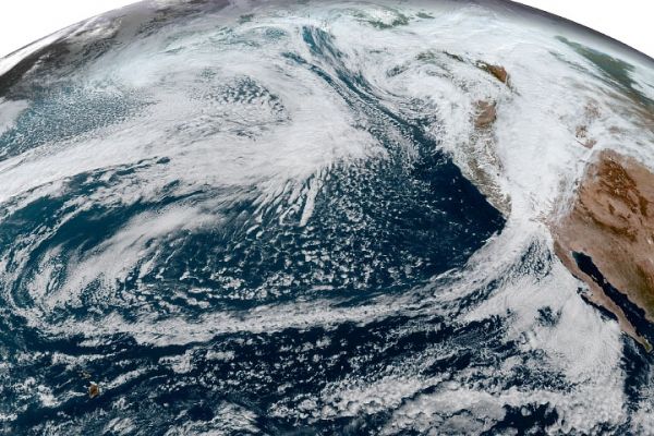
One of the most intense extratropical cyclones ever to strike the Pacific Northwest drew an equally historic amount of moisture onto the West Coast of North America on October 24-25, 2021. The storm off the coast of Washington—with a central pressure of 942.5 millibars, equivalent to a category 4 hurricane—was the second extreme low-pressure storm in the North Pacific in a week. Both exhibited pressure drops of more than 24 millibars in 24 hours, making them “bomb cyclones.”
The two storm fronts directed streams of moisture from north of Hawaii toward the West Coast in long, narrow bands of moisture known as atmospheric rivers. Atmospheric rivers account for up to 50 percent of all rain and snow that falls in the western United States.
The parade of storms brought high winds and extreme precipitation that doused wildfires and brought some relief from extreme drought to Central and Northern California. But the events also caused power outages, flooding, landslides, and mud and debris flows that washed out roads.
Read more at: NASA Earth Observatory
Photo Credit: NASA Earth Observatory