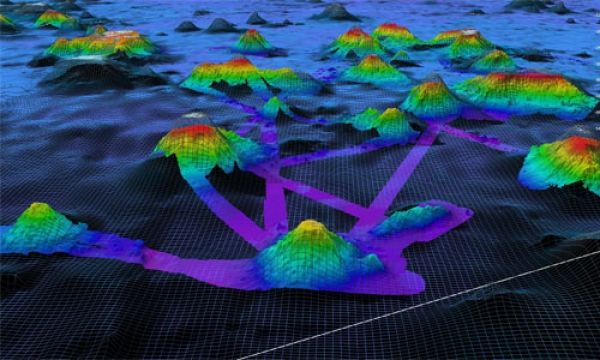
Two million square kilometers. Or 772,204 square miles. That’s more than one quarter the size of the contiguous United States. And it’s the area of seafloor mapped by NOAA Ocean Exploration using the modern, high-resolution multibeam sonar system aboard NOAA Ship Okeanos Explorer since the ship was commissioned in 2008.
There’s so much to thank the ocean for. From the air that we breathe to the food on our plates to the climate that makes our planet habitable. Nevertheless, so much of our ocean, the deep ocean in particular, remains unexplored.
Exploration leads to discovery, and the first step in exploration is mapping. Seafloor mapping provides a sense of the geological features and animals of our deep ocean and sets the stage for discoveries to come. But, it’s not just about the thrill of discovery. Deep-ocean seafloor mapping has many benefits. Broadly, it provides insight into geological, physical, and even biological and climatological processes, helping us better understand, manage, and protect critical ocean ecosystems, species, and services for the benefit of all. In addition, it supports navigation, national security, hazard detection (e.g., earthquakes, submarine landslides, and tsunamis), telecommunications, offshore energy, and more.
Continue reading at NOAA Ocean Exploration
Image via NOAA Ocean Exploration