In the classic example of mountain-building, the Indian and Asian continental plates crashed – and continue colliding today – to form the world’s largest and highest geologic structures: the Himalayan Mountains and the Tibetan Plateau.
Despite the importance of these formations, which influence the global climate through atmospheric circulation and seasonal monsoons, experts have proposed contradicting theories about how tectonic plates below the surface created the iconic behemoths. Now, using geochemical data from 225 hot springs, scientists have mapped the boundary between the Indian and Asian continental plates, shedding light on processes occurring deep below the surface. The findings, which have implications for mineral formation, appear in the current issue of Proceedings of the National Academy of Sciences.
“A principal debate amongst geologists is whether or not continental collision looks like oceanic collision,” said senior study author Simon Klemperer, a geophysics professor at Stanford’s School of Earth, Energy & Environmental Sciences (Stanford Earth). “Because there are too few measurements, seismology wasn’t giving us the answer – that’s why I took up geochemistry as a totally different way to measure things.”
Klemperer has spent the better part of a decade traveling to Tibet and India to collect samples to support his theory that chemicals bubbling to the surface could be used to understand what’s happening 50 miles below. He and his colleagues tracked down remote geothermal springs for hundreds of miles across the mountains and plateau – about the distance from Canada to Mexico in the western U.S.
Read more at: Stanford University
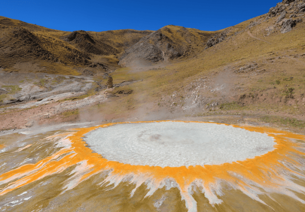
Pictured is a continuously spouting cauldron of near-boiling water, one of a dozen spanning a 10-acre geothermal field at Mangra in southern Tibet. Helium-isotope geochemistry shows it sits above the northern edge of the Indian plate 50 miles below, where India is underthrusting Asian crust to build the Himalayas and Tibetan Plateau. (Photo Credit: Ping Zhao)


