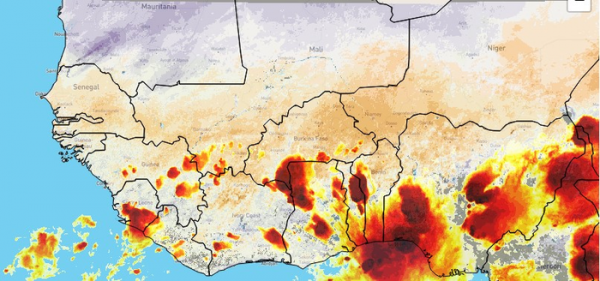
An online portal developed by the UK Centre for Ecology & Hydrology (UKCEH) will enable forecasters in West Africa to provide communities with earlier and more reliable warnings about large storms.
Storms in the Sahel region, which can reach over 100km in size, have become more extreme since the 1980s due to global warming, with more intense rainfall.* Severe flooding during the monsoon from June to September causes human and livestock deaths, plus damages property and infrastructure, leaving thousands of people without homes and livelihoods.
State-of-the-art weather forecast models struggle to predict where new storms will hit and how strong they will be, which makes it difficult to provide warnings to people in affected areas so they can protect their property and livestock or get out of harm’s way.
National forecasting agencies in Africa can already make predictions of how storms will behave in the next couple of hours by observing current atmospheric conditions, and analysing hundreds of historical storms.
Now, thanks to a recent breakthrough by UKCEH scientists, they can make these short-term forecasts, known as ‘nowcasts’, for six hours ahead and with a higher degree of accuracy. The new research found drier soils can increase the intensity of storms when they are on the move, affecting where they travel and the amount of rainfall they produce.
Read more at: UK Centre for Ecology & Hydrology
This image from the portal shows storms (in red) across West Africa on the evening of 27 April 2022. (Photo Credit: © Mapbox © OpenStreetMap © 2022 EUMETSAT)


