Safe and uninterrupted road travel is crucial in the aftermath of storms so that people can access medical treatment, downed power lines can be removed and communities can begin a return to normalcy.
Researchers with the FAMU-FSU College of Engineering’s Resilient Infrastructure and Disaster Response (RIDER) Center are investigating better ways to predict where road-clogging debris will be most severe after tropical cyclones. Their latest paper was published in the International Journal of Disaster Risk Reduction.
“This research is especially relevant as hurricane season approaches because it reminds us that we need a variety of tools to properly respond to these storms,” said Eren Ozguven, RIDER Center director and the paper’s senior author. “This paper describes an important tool and applies it to disasters in the Florida Panhandle.”
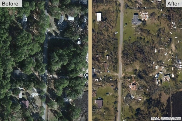
Researchers used satellite images to measure the amount of vegetation in Bay County, Florida, before and after two tropical storms and three hurricanes, including Hurricane Michael, a Category 5 storm that devastated the county in 2018. That gave them an estimate of how much vegetative debris those storms caused and where debris was heaviest. They were able to correlate debris measurements with factors such as wind speed, initial amount of vegetation and roadway density.
Continue reading at Florida State University
Image via Florida State University