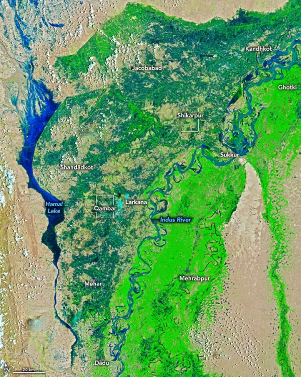
Since mid-June 2022, Pakistan has been drenched by extreme monsoon rains that have led to the country’s worst flooding in a decade. According to Pakistan’s National Disaster Management Authority, the floods have affected more than 33 million people and destroyed or damaged more than 1 million houses. At least 1,100 people were killed by floodwaters that inundated tens of thousands of square kilometers of the country.
The false-color images above were acquired by the Operational Land Imagers aboard the Landsat 8 and Landsat 9 satellites on August 4 and 28, respectively. The images combine shortwave infrared, near infrared, and red light (bands 6-5-4) to better distinguish flood waters (deep blue) beyond their natural channels.
The worst flooding occurred along the Indus River in the provinces of Punjab, Khyber Pakhtunkhwa, Balochistan, and Sindh. The provinces of Balochistan and Sindh have so far this year received five to six times their 30-year average rainfall. Most of that arrived in summer monsoon rains.
Read more at: NASA Earth Observatory
Photo Credit: NASA Earth Observatory


